
WinFly
 6 comments
 MOSS LANDING, CALIFORNIA– To introduce you to McMurdo Station, Antarctica, let’s get right into the jargon. There are abbreviations and acronyms for everything, and the new language adds to the disorientation of being in a new, strange, and extreme place. The OAEs (Old Antarctic Explorers) love confusing the FinNGees (F*** New Guys).
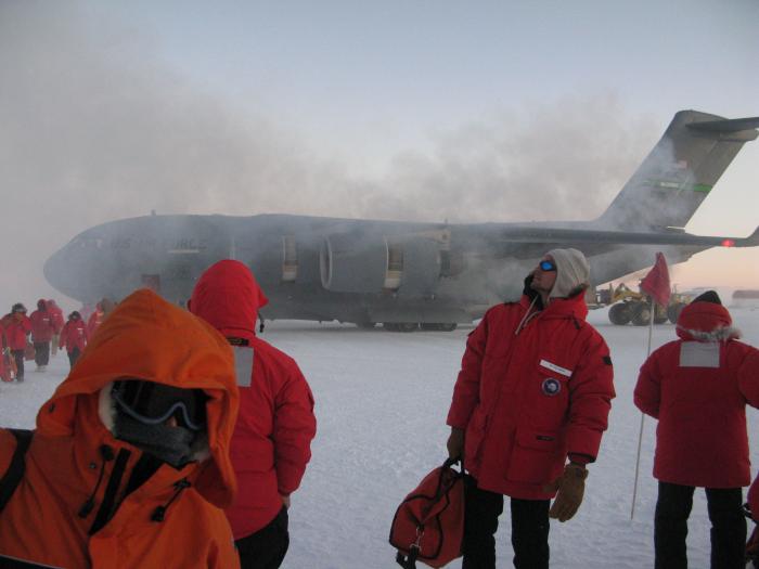
Deplaning at McMurdo during WinFly 2009. Photo by Dustin Carroll.
What is WinFly? It is the Winter Flight. When the sun first peeks above the horizon, a flight attempts to land in the small window of daylight. Originally, it was a single flight, but this year, it was 4 flights. Within a week the population went from the 153 people who have been there all winter, to a bustling 476. It is a time of change, and that can be uncomfortable for everyone.
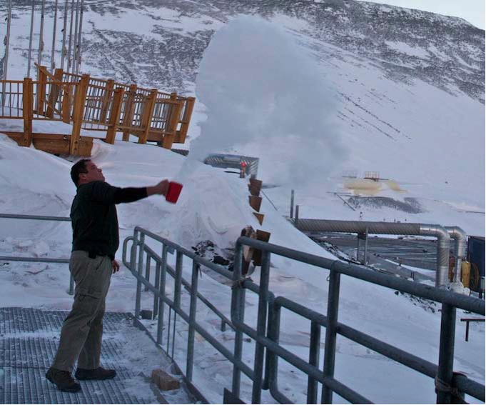
That cup of tea is a mite cold! Photo by Holly Troy.
For the SCINI project, WinFly was three of our engineers leaving sunny California for the dark of the austral winter. Things have been much quieter in the home lab since then. And the reports from McMurdo have been excellent. First, they are overeating successfully, increasing their calorie intake to deal with the extreme cold, which got down to a chilling minus 90 degrees C. At that temperature, the classic cup of boiling water thrown in the air creates a cloud of finest ice crystals as it instantaneously freezes. Second, they are taking a lot of pictures of the gorgeous atmospheric phemonena, so that they can make me extremely jealous because I have never seen them. And most importantly, SCINI is working very well as they refine the software and firmware. Marco, our navigator, been working on the wireless navigation system that should allow us to go deeper and in more rugged terrain, yet know SCINI’s location more accurately. We will need very precise position data later when we attempt to mosaic multiple images together to create small maps of the seafloor and animal distributions. Bob, the chief engineer, is perfecting the tether system for neutral buoyancy, so that it does not pull the vehicle to the surface nor sink her to the depths. With SCINI’s depth capability of 300 m, and a tether that is 8 mm in diameter, tether drag and steering can become significant issues. Dustin, our software engineer, has been working to integrate a heading indicator into the piloting system, a challenge when you are so close to the pole that traditional compasses do not work very well.
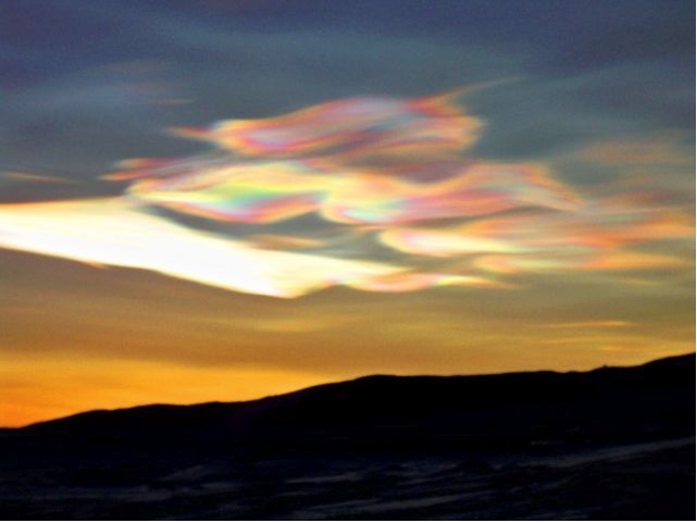
Nacreous clouds form in the stratosphere at very low temperatures. Photo by Marco Flagg.
Back home in Monterey Bay the team that will deploy at MainBody – when the population of McMurdo will double – continues to build extra hardware, plan the field work, and tie up loose ends. We leave on September 30th!


I love this post! What you are doing here is sooooo amazing and exciting! I am currently studying to be an ecological engineer and have obtained my GIS analyst certification. I am so excited about all the work being done in mapping the ocean floor as well as your work at the pole.
Thanks guys,
Julie
Keep me posted here on FB or jgirl1777 [at] msn.com. Thanks! Julie
That picture of nacreous clouds boggled my mind. I have never seen such irisization (those incredible colors). I wonder if it was taken from McMurdo, and how high these clouds are. I’ve seen pictures of noctilucent or polar stratospheric clouds (which help create the ozone holes); but they weren’t as colorful.
–Roger Williams, ex-NOAA (went to Barrow, then Samoa but not the ice).
I wish, I was there……..Thatz just fascinating, probably the greates experience of lifetime. McMurdo is just like an wonderland for me, and as a PhD candidate, it’d be a great experience to work there.
Hi Julie,
It sounds like you are heading in an exciting direction yourself. We are working to build a GIS with the data we recently collected near some icebergs, so hopefully I will have some cool maps to post soon.
Best, Stacy
Hi Roger,
Nacreous clouds are the same as polar stratospheric clouds, so they form very high up, at 15,000–25,000 meters altitude. The pictures were taken from McMurdo, and I agree they are gorgeous!
Best, Stacy