Antarctic Geology
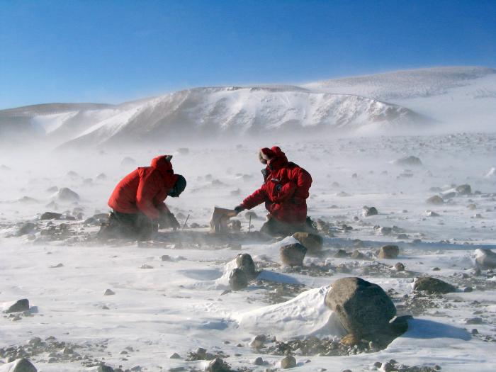
Geologists collect rock samples in the Transantarctic Mountains.
At first glance, Antarctica seems to turn a cold shoulder to geologists. How do you study minerals and landforms on a continent that’s almost entirely covered by ice? But dauntless geologists are using a full range of tricks to peer under the ice . . . and what they’re finding is a big surprise.
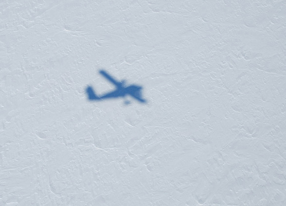
A Twin Otter aircraft casts its shadow as it emits ice-penetrating radar waves. These waves reflect off the bedrock back to the aircraft revealing information about the geology beneath the ice.
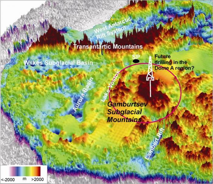
A map of the mountains beneath the ice.
Take the apparently flattish slab of ice that is east Antarctica. Hiding beneath is a mountain range to rival the Himalayas, a range known as the Gamburtsev Mountains. These mountains are completely buried by ice, but their presence was first signaled by telltale wobbles in the strength of gravity measured from above.
What’s most surprising about this hidden mountain range is that, by all rights, it shouldn’t be there. East Antarctica is understood to be an ancient continental shield, a stable, unchanging plateau at the center of a tectonic plate, far from the mountain-building phenonena—such as volcanoes and plate collisions—that occur at plate boundaries. The presence of a mountain range in the middle of a continental shield like east Antarctica is, geologically, astounding. Says geologist Robin Bell, “It’s almost as if an archeologist in Egypt opened up a tomb and found an astronaut inside.”
Bell hopes to solve the mystery of the Gamburtsev range using data from roughly 200 flyovers, including radar signals (which penetrate through ice to create an image of the land surface beneath), magnetic measurements, gravity measurements, and laser sounding of the surface ice. This massive data collection effort, called the GAMBIT project, should yield the clues necessary for Bell and other Antarctic geologists to figure out when—and how—the Gamburtsev Mountains formed.
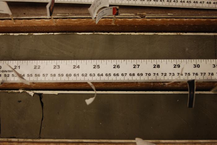
Sediment coring is another method scientists use to study the geology of Antarctica. Analyzing cores like these—from the ANDRILL project on the West Antarctic Ice Sheet—helps scientists understand Antarctica’s past climate and geologic history.
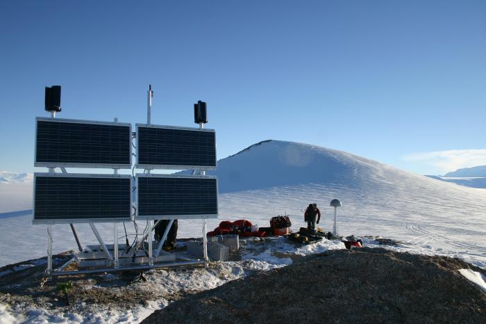
POLENET researchers have to find exposed rock to place their high-precision GPS units. The units are powered by solar panels during the summer and wind generators and batteries during the polar darkness.
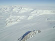
Western Antarctica—younger and more geologically active than its eastern counterpart—holds its own share of mysteries. One stands out in literal stark relief: the Transantarctic Mountains. This craggy rock spine erupts from the ice in a line that marks the boundary between east and west Antarctica. The range seems to be associated with a period of rifting—stretching of the earth’s crust—that began in west Antarctica 180 million years ago, and may or may not be ongoing. Data from the POLENET project, mainly from seismic and GPS sensors drilled into coastal bedrock, will help establish whether rifting continues in west Antarctica. “I’m sure that when we get these instruments in place, there are going to be a lot of surprises,” says POLENET geologist Terry Wilson.
Already, GPS data have confirmed that Antarctica is rising (geologists say “rebounding”) from the loss of ice during the last ice age, which ended 12,000 years ago. The land itself is rising just a few millimeters a year. This may seem slight but it’s still enough to significantly impact calculations of the changing thickness of ice sheets. Scientists the world over are watching the Antarctic and Greeland ice sheets with keen interest, because as they melt in response to global warming, global sea level will rise, wiping out coastal communities.
The fate of the ice sheets may rest, literally, on what’s underneath them. Research by Slawek Tulaczyk and others suggests that the motion of ice sheets depends on interactions between the ice and the rock below. Lakes of melted water under the glaciers may reduce friction and cause ice sheets to flow faster to the sea. Meanwhile, the breakup of ice shelves around Antarctica means fewer buttresses to hold back ice sheets from advancing rapidly into the sea.
The Transantarctic Mountains.