Follow the 16th Annual Summer Cruise of the Palmer LTER
 No comments
 For those of you interested in following along with us as we work through our stations, you can track our location, weather, and position status online! Just click here, (or go to website address http://www.sailwx.info/shiptrack/) to follow different research vessels including ours, the ARSV L M Gould. Simply enter the name of the ship and navigate through to see the ship’s position and location.
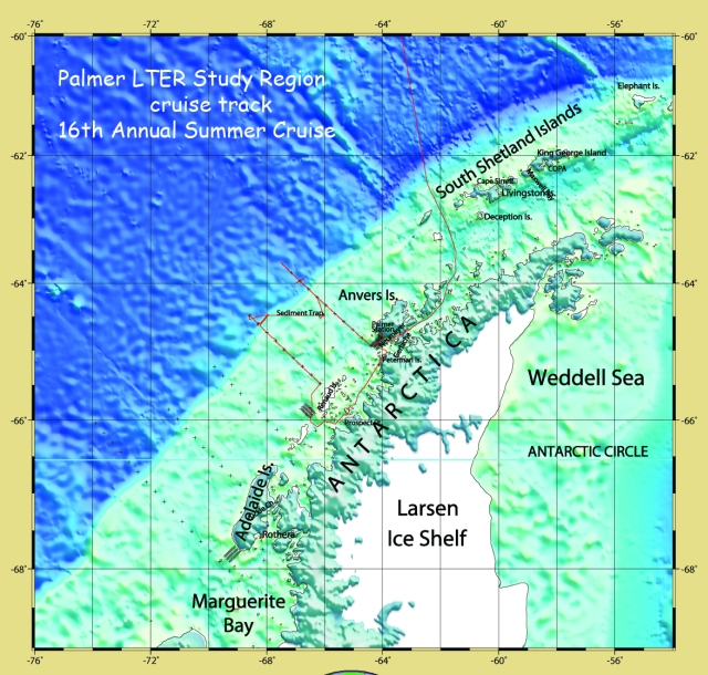
Our cruise track over the first part of the 16thannual summer cruise of the Palmer LTER, including the end of our southbound crossing of Drake Passage and the two northern-most transect lines of our summer cruise. The 5 standard transect lines are shown as a series of + signs, one for each station on each line.
We crossed Drake Passage, entering Bransfield Strait just south of Deception Island, and then went south through Gerlache Strait to Palmer Station on Anvers Island. Once underway for science, we headed toward the east side of Peterman Island (small print) for one station, then behind Renaud Island where we did another station. Just south and west of Renaud Island we put in a SASSI mooring (more on that later), and then commenced stations on the transect line west of Renaud, moving out to sea. From the seaward end of this line we moved to retrieve and re-deploy the sediment trap on 10 January. For the last 3 days we have been doing stations along the transect line just south of Anvers Island, moving inshore to do a fine scale study of the basin just south of Palmer Station, seen as the grey blocked out section just south of the station.