
Where in the World Is Ice Stories?
 1 comment
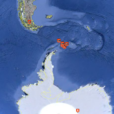
Browse the new Ice Stories layer on Google Earth to follow the locations of polar expeditions and research in the Arctic and in Antarctica. You’ll need to have the latest Google Earth browser (a separate Web application) to view the locations on this Earth globe simulator. Download it here.
SAN FRANCISCO, CALIFORNIA– For those who have never been to the world’s polar regions, and even for those who have, one of the difficult things to imagine is the sheer size and geography of Antarctica and the Arctic. From the beginning, as we started working on Ice Stories with our scientist-correspondents, we hung large maps on the wall to orient us to all the field sites and journeys where this research happens. These maps helped us comprehend how far-flung these field camps are.
Just getting from San Francisco to McMurdo Station, Antarctica, is a three-day journey: 14 hours to New Zealand, a day-and-a-half layover in Christchurch to get outfitted with cold weather gear, and a five- to eight-hour southbound flight (depending on the plane) to get to McMurdo Station on the continent’s southern coast. Our trip to the South Pole, in the center of the continent, was another five-hour flight on a ski-equipped C-130 military plane.
Maria Vernet and Cassandra Brooks’s journeys were even more arduous: They each flew to South America and boarded a ship, then sailed south from Punta Arenas. The Exploratorium’s trip to Barrow, Alaska, was a little more straightforward: a mere three commercial flights from San Francisco. Greenland took a bit longer: a cross-country flight to Albany, New York, a two-night layover, then a predawn hop on an Air National Guard flight to Kangerlussuaq. These just describe the first part of the journeys: Maria ended up traversing thousands of miles of the Southern Ocean and Weddell Sea; Zoe Courville and the Exploratorium’s Lisa Strong flew up to Summit Camp at the top of the Greenland Ice Sheet from Kangerlussuaq, a five-hour plane trip. Phil McGillivary and Kevin Fall boarded a Coast Guard Ice Breaker in Barrow, Alaska, and cruised north to the Beaufort Sea. This summer Billy D’Andrea is doing field work in the Lofoten Islands off NW Norway, and Zoe Courville is reporting from NEEM, a Danish ice-coring camp on the top of the Greenland Ice Sheet.
It’s a lot to keep track of, so the Ice Stories Web team is launching a new layer in Google Earth/Ocean to help you follow along on these scientific journeys. We’ve embedded blogs and photos into this handy map-based tool so you can see exactly where our scientists have been and what they did when they were so far away from home. If you don’t already have Google Earth, you’ll need to download the software, but then you can do some virtual science trips to the farthest reaches of our planet. Happy travels!


Nice post and blog! Greets.