Tagging Icebergs From Above
 No comments
 SOUTHERN OCEAN– One very important piece of information needed to study an iceberg is its geographical location at any given time.
By analyzing the iceberg’s position with respect to the ship we can relate the nearby ocean properties to the presence and the distance of the iceberg. For that purpose, Steve Etchemendy and Kim Reisenbichler from the Monterey Bay Aquarium Research Institute (MBARI) have modified a remote-controlled airplane to carry a Geographical Positioning System unit for marking icebergs.
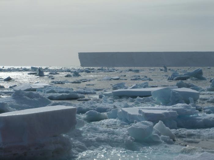
A flat, tabular iceberg in the Southern Ocean last year.
The GPS units are being delivered within a plastic football dropped on top of the iceberg during flight. On the first try, the plane took some video of the top of the iceberg. Steve and Kim need to wait for good weather (clear skies and winds less than 10 nautical miles per hour) to test and use the GPS-delivery system.

MBARI’s remote control plane with a GPS enclosed in the orange football.
We arrived to a new study area this morning. The winds died down last night from 20 to 2 knots, making the weather ideal to fly the remote controlled plane. As we had finished working with SS-1, we left this morning after breakfast and arrived to Iceberg A43k at mid-morning.
The new location is about 20 miles South of SS-1. A43k is a large iceberg. It is taking more than 6 hours at 12 nautical miles per hour to navigate around it. Our best estimate of the iceberg’s size is 16 nautical miles long and 8 nautical miles wide. We will know the exact size once we finish the circumnavigation.
The plane had a successful mission dropping the GPS unit on top of the iceberg. We are receiving the iceberg position via satellite every 6 hours. In addition to the ship’s radar, the GPS will greatly help our ability to pinpoint the iceberg’s position (latitude and longitude).

Iceberg A34K.