One Month in the Deep Field, Part 4
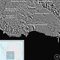
CHRISTCHURCH, NEW ZEALAND– In Monday’s dispatch, I described how we use passive seismometers to measure the movement of Whillians Ice Stream.
The other science component of the project is to image the subglacial lake underneath Whillans Ice Stream. To do this, we set off a series of explosions, with instruments called geophones to measure the waves emanating from the explosions. Because the waves bounce off all the layers of the subsurface, we can then figure out how deep all the layers are and eventually produce a cross-sectional map of what lies beneath the surface! Have a look at this video of the explosions.
Get the Flash Player to see this player.


I’m also interested in geophysical exploration in ice covered regions using explosives as the source. I can perform hydro-code modeling of the explosive detonating and its interaction with the ice. Do you have any data you can share on the the size of the crater produced in ice versus the charge weight used.
Dale-
The shots we used were buried about 2 meters below the surface, in the firn. As I’m sure you’re aware, the physical properties of firn differ quite significantly as compared with ice. I’d be happy to share data with you relevant to the explosions. Please email me and we can talk about specifics, etc: jwalter@pmc.ucsc.edu.