
Mapping the Icy Continent from Above

This one-of-a-kind airplane features an array of instruments for studying the East Antarctic Ice Sheet and the bedrock below: radar, a magnetometer, laser altimeters, and a gravity meter. Skis allow the team to land nearly anywhere in Antarctica if necessary.
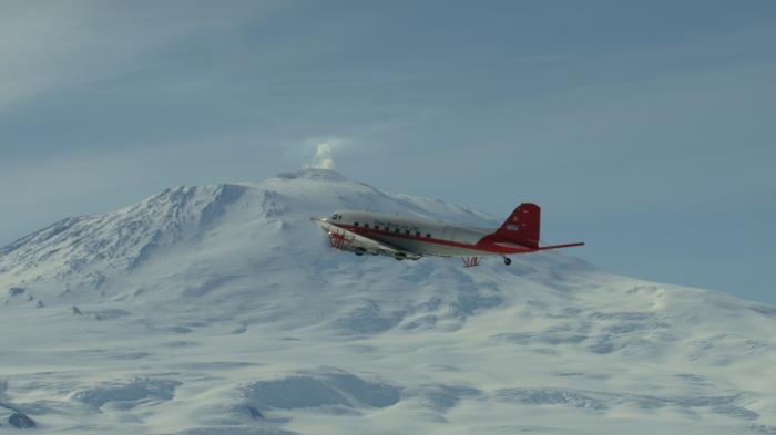
The specially-quipped C-47 aircraft is designed to conduct long-range airborne surveys in Antarctica and Greenland.
The East Antarctic Ice Sheet is the sleeping giant of the cryosphere: it covers more than 95% of the Antarctic continent and locks up more than 60% of the world’s supply of fresh water. Considered much more stable than its smaller counterpart in West Antarctica, scientists are turning more attention to studying the history, structure and dynamics of this mysterious icy world. Instead of taking the stability of the ice sheet for granted, scientists from many different countries are digging into East Antarctica’s climate history to help predict how this vast ice sheet could respond in a warming world.
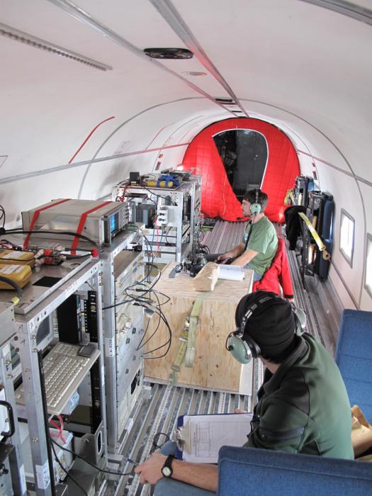
Graduate students Dusty Schroeder (foreground) and Jamin Greenbaum (rear) monitor instruments during a survey flight.
As a member of a research group at the University of Texas, Austin, Jack Holt participated in a multinational project called ICECAP to survey an enormous, unexplored part of the East Antarctica Ice Sheet. Building on their research experience of the last two decades, the UT team employed a ski-equipped aircraft outfitted with unique instrumentation, including an ice-penetrating radar capable of mapping the surface, internal layers, and the bottom of the ice. Other instruments revealed information about the density and type of the underlying rocks. The aircraft was also fitted with a suite of secondary instruments including specialized GPS receivers and cameras. One of the goals of ICECAP was to find the oldest ice on the continent, the site of a future ice-coring project to unlock climate records that go back a million years.
Data from the ICECAP project will help scientists understand how the East Antarctic Ice Sheet, with its enormous supply of fresh water, might react to changing environmental conditions. The ice in the target area is generally over 2 miles (3.5 km) thick and the bedrock lies mostly below sea level, making this ice potentially more likely to make a rapid contribution to sea level rise than the ice sheets in Greenland or West Antarctica. But the largely unknown continent buried beneath is also important for forecasting how the ice might respond to a warming world: The slope and roughness of the ground, the presence of water (including subglacial lakes), and the type of rocks are all factors.
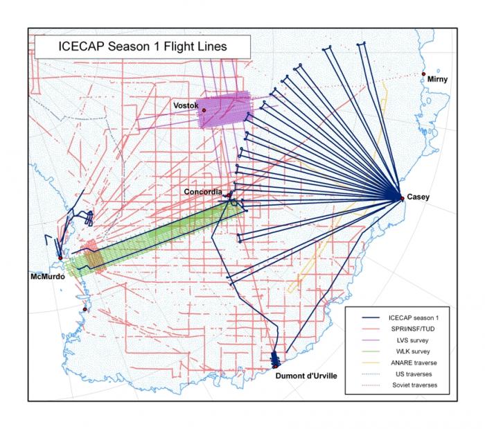
ICECAP season 1 flight lines.