Science Camps and Glacier Watch

Ilulissat, Greenland.
Summer is an intense time for science in Greenland. With 24 hours of daylight to work with and a melting ice cap to study, researchers spread along the edges of glaciers and on camps atop the summit of the ice cap to learn all they can about the dynamic nature of ice, wildlife, climate, and geology in a time of rapid climate change at the poles.
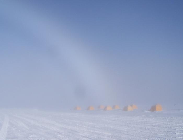
An ice bow stretches over sleeping tents at a scientific research camp on the Greenland ice cap.
In July of 2008, an Exploratorium crew journeyed to Greenland and documented all the science we could stuff into three weeks. We camped and hiked with glaciologists, biologists, and climate researchers; recorded interviews; wrote dispatches; and captured moving and still image scenes of this gorgeous icy island.
Our first stop was the town of Kangerlussuaq, nestled along a 100-mile- (160-km-) long fjord with the looming ice cap behind it. We reached Kanger, as it’s often called, via an Air National Guard military transport from Scotia, New York, and we stayed at the Kangerlussuaq International Science Support facility, aka “KISS.”
We caught up with Billy D’Andrea, our Ice Stories correspondent from Brown University, who is studying lake sediments for clues of our recent climate past. We also hitched a ride and hike out to Tom Neumann’s camp along the glacier edge.
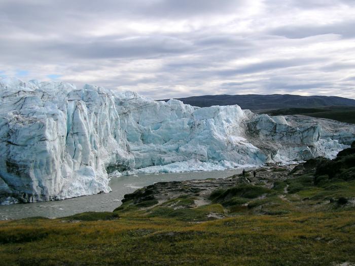
The edge of the Greenland Ice Sheet near Kangerlussuaq.
Tom is a glaciologist from the University of Vermont who is interested in the history of the Greenland Ice Sheet, in particular the last time Greenland was free from its mantle of ice. His team studies this by patrolling the edge of the glacier and collecting rocks poking out from the base of the ice sheet. These rocks contain clues about the last time they were directly exposed to cosmic rays from the sun (the last time they weren’t covered by ice).
From Kanger, we flew to the lovely town of Ilulissat, a major tourist and science destination on the island. Ilulissat means iceberg in Greenlandic, and the town is aptly named situated as it is near the outlet of one of the world’s fastest-moving glacier, the Jakobshavn.
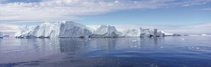
Icebergs at the mouth of Jakobshavn Isfjord, Ilulissat.
Jakobshavn is Greenland’s largest glacier and it regularly calves huge icebergs in the summer season, some as large as about a cubic mile in size. Mark is a glaciologist from the University of New Hampshire, and studies the flow rate of the Jakobshavn glacier. This one glacier, a fraction of the 630,000-cubic-mile ice sheet that covers most of Greenland, produces 35 billion tons of icebergs every year, nearly all the bergs that threaten ship traffic in the northern Atlantic, and is almost certainly the origin of the iceberg that sunk the Titanic.