Antarctica’s Gamburtsev Mountains
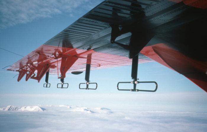
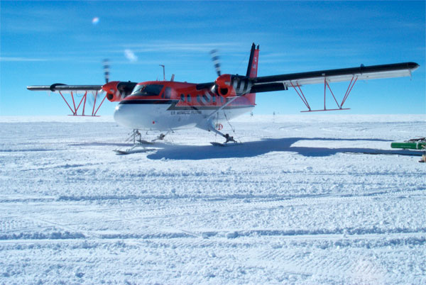
Nine aircraft are involved in this ambitious project, including two Twin Otters such as this one, specially equipped for the geophysical survey.
Two survey aircraft will use RADAR, lasers, and other instruments to look down into the ice sheet at the hidden mountains below.
Summer is inhospitable near Antarctica’s Pole of Inaccessibility, the most remote part of the most remote continent on earth. Temperatures hover around -35 degrees Fahrenheit and the thin atmosphere holds little oxygen. But an international group of scientists spent four weeks working here to solve a long-standing mystery: How did a massive hidden range known as the Gamburtsev Mountains form in the middle of Antarctica? It was no picnic—working in a place so inaccessible and barren is like establishing a base on another planet. Expedition members encountered conditions so extreme they couldn’t fully acclimatize, even after weeks of habitation, and could function at only 50–80 percent of their normal capacity. But the suffering was worth it: Data they uncovered could answer fundamental questions about the origin and evolution of Antarctica and, by extension, the climate experienced on earth today.

A Twin Otter aircraft casts its shadow as it emits ice-penetrating radar waves. These waves reflect off the bedrock back to the aircraft revealing information about the geology beneath the ice.
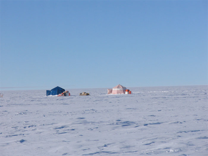
The AGAP camp under construction near the Pole of Inaccessibility — about as remote as you can get.
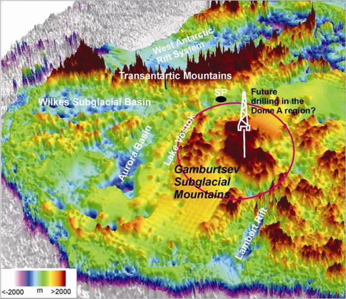
A map of the mountains beneath the ice.
The AGAP (Antarctic Gamburtsev Province) expedition was the first systematic study of our planet’s last unexplored mountain range, which lies about 2 1/2 miles (4 km) under the most massive ice sheet on earth. The enigmatic Gamburtsev Mountains, which rival the Alps in size, were a surprise discovery fifty years ago, made by a group of Russian scientists setting off explosives for a seismic study. Fast forward to a half century later, and still very little is known about the Gamburtsevs; their shadowy shape, some 340 miles (550 km) wide and 2 miles (~ 3 km) high, has been gleaned from only a few data records.
Working against time in a forbidding climate, scientists and engineers created the first detailed maps of the Gamburtsev Mountains. Two survey aircraft, one from the United States and one from Britain, used RADAR, lasers, and other instruments to look down into the ice sheet, effectively conducting a continental-scale MRI of the ice sheet and the hidden mountains. Scientists on a third aircraft buried seismic instrumentation in the ice sheet to measure the energy from earthquakes around the globe. Working together, these teams seek to answer basic questions about the origin of the mountains. When and how did such high mountains grow in the interior of a continent as ancient as Antarctica? Did they form like the Hawaiian Islands with a hot plume welling up beneath the region? Or were they created like the European Alps with colliding continents pushing the mountains into the sky?
Follow the adventure with AGAP team members Adrienne Block and Beth Burton. Project Leader, Robin Bell, a geophysicist from the Lamont-Doherty Earth Observatory of Columbia University, contributed microblog posts on Twitter.