
Take Me to the River, Drop Me in the Water
 4 comments
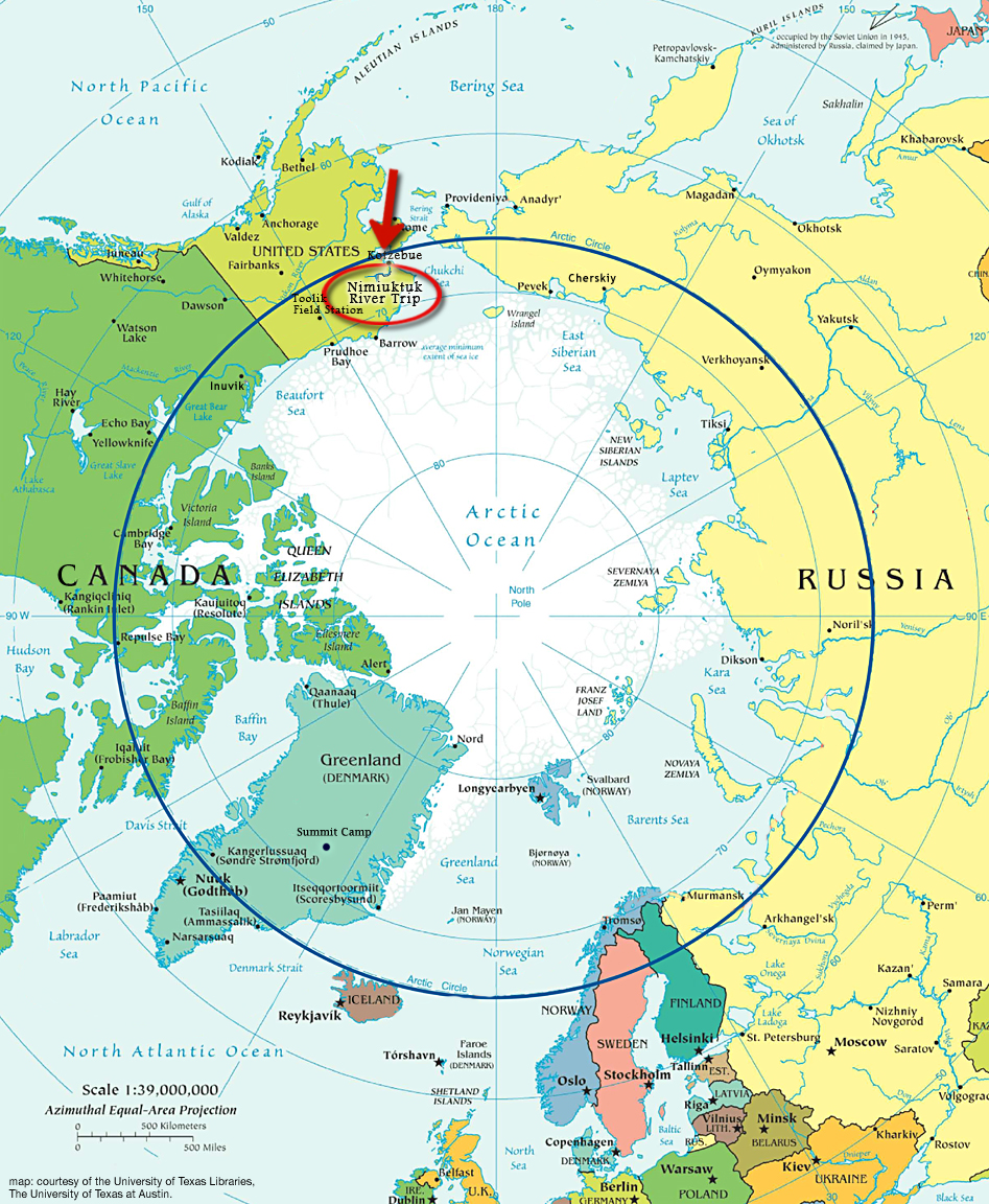
 Journal Entry 4: Monday, June 30th, 2008, 9:00am
NIMIUKTUK RIVER SANDBAR, BROOKS RANGE, ALASKA– If only it were that easy! The pace of this trip has been so rigorous that I’ve hardly managed to journal.
Yesterday we made the strenuous portage from the lake where we were dropped to Seagull Creek, where the boating commenced. We inflated the boats, strapped down the rowing frames, and bounced off obstructions “like a pinball” (Mark’s words) until reaching the Nimiuktuk River several miles later.
By the time we hit “the Nimi,” it was 9pm and we were tired, but the midnight sun again shone brightly and we enjoyed the larger channels and avoidable obstructions. We pulled off the river at 11pm, at the base of the hill we will sample today.
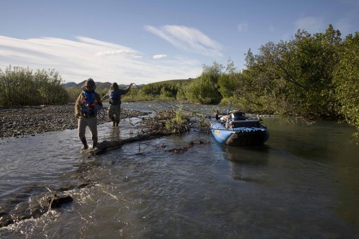
Lisa and Mark ‘lining’ their boat past an obstacle on Seagull Creek

Greta paddling late at night on the Nimiuktuk River.
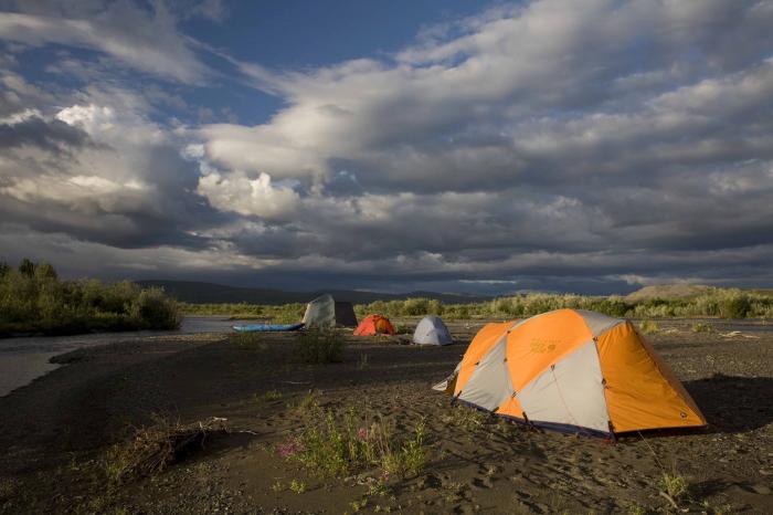
Our 2nd camp, around midnight.
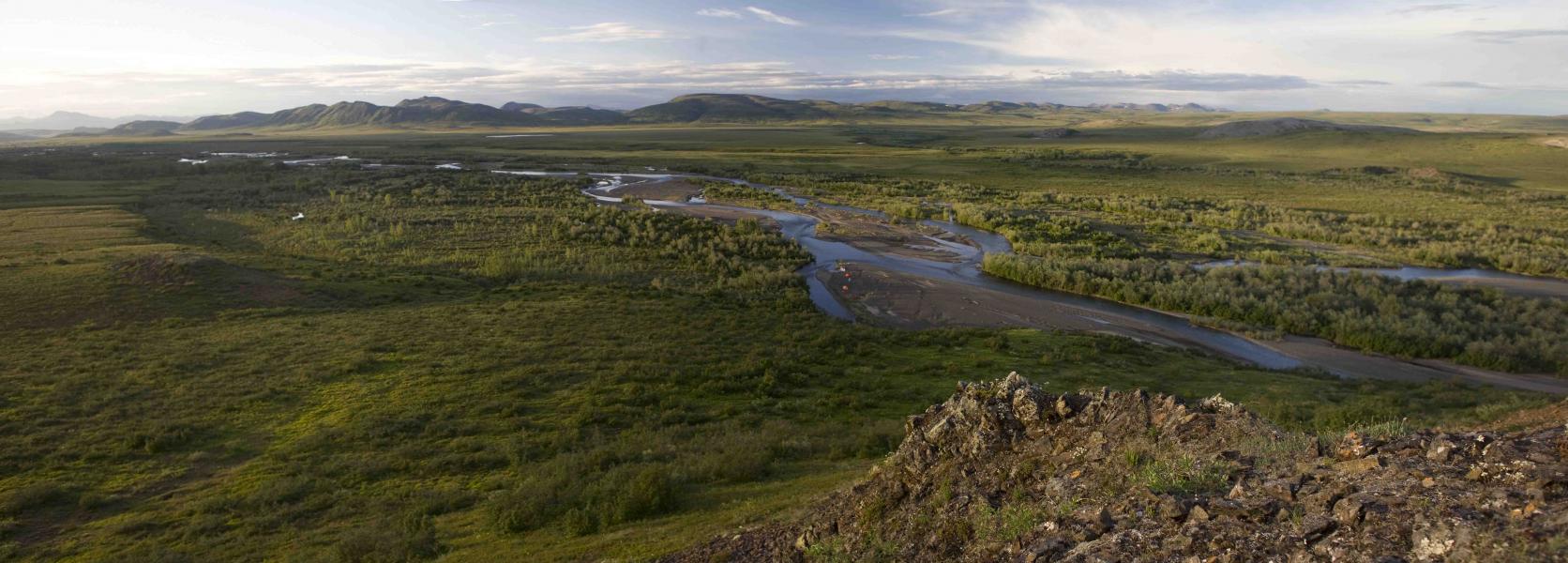
Panorama taken near the 2nd camp, with our tents barely visible down on the sandbar.
Over the last decade, I’ve been rephotographing landscapes that were first photographed in the late 1940’s. This “repeat photography” has been valuable in helping to understand how vegetation has changed during this century. Normally, in a place where fire is part of the natural system, a change in vegetation over a half-century period would likely be interpreted as vegetation succession between fires. In other words, it could be described as a cyclical change and part of the natural cycle, rather than a directional change.
In the Arctic tundra, however, where fire and other large-scale disturbances are rare, the vegetation is thought to be in relative equilibrium with climate. Thus, a rapid change in vegetation over a large area suggests that whatever is driving the change is of equally short temporal scale and equally large spatial scale. The only force operating on that scale is climate warming, which leads us to believe that it’s responsible for the vegetation changes visible in the repeated photos.
Unfortunately, it’s not quite that simple. The repeated photos show that shrub patches are expanding in some areas, while in other areas shrub patches are stagnant. The goal of this field expedition is to find properties of plants or soils that are different in shrub patches that are expanding, than in shrub patches that are stagnant. That’s why we’re measuring so many different things – we don’t yet know which soil or plant properties will allow us to differentiate between expanding and stagnant shrub patches. Eventually, we would like to identify expanding and stagnant patches across the landscape using diagnostic properties that we measure on this trip, instead of relying on repeat photography.
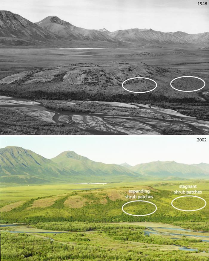
Old and new photos, showing the locations of today’s sampling. The left circled area is an expanding shrub patch; the right is a stagnant one.


We will be doing a drop off Caribou 10 day float hunt this Sept. (in this same area.) We will be floating down to the Noatak. Is there any pointers you could give us?
how long is the portage from the lake to seagull lake? Is there a trail of any kind??
to Seagull creek.. sorry
Hi Jerry,
I do have some pointers. If you have not already, you should download Google Earth. There is no comparable tool for reconn-ing trips like these. You can measure the length of lakes and even tilt the landscape and recon vistas for hunting.
The main problem you will face in September is low water. The advantage is that all of the sandbars that were inundated for our put-in (during the end of spring run-off) will be available landing strips for you. As a result, the pilot can probably put you down right next to the river, but I wouldn’t go much higher than the confluence with Seagull Creek, because there won’t be much water. This suggests that you’ll probably go in on wheels instead of floats, though that depends on the pilot and available plane. The lakes aren’t huge up there, especially higher in the catchment, and that bears on the size of plane you can use.
To answer your specific question, there are no trails whatsoever, other than game trails. The portage from the lake to Seagull Creek isn’t horrific, but Seagull Creek will not be boatable due to low water. The portage directly to the Nimi is about the same distance, but with tussocks.
Good luck. If you have any other scouting questions, email me at kentape at hotmail dot com.
Ken