
Iceberg City
 3 comments
 Temperature -2°C, wind 30 kts, 3 meter swells
Transiting back to Site U1359
Position: 64º 34’S, 140º 30’E
Water Depth: 3700 meters
The scene outside: 2 days of storms and lots of icebergs
ABOARD THE JOIDES RESOLUTION, OFF THE COAST OF WILKES LAND, ANTARCTICA– Our latest drilling target is in an area where sediments that document the transition of Antarctica from the “Hothouse” to the “Icehouse” can be easily reached at shallow depth beneath the seafloor. We drilled for 18 hours and then had to pull the drill pipe up out of the hole and reposition the ship to avoid a large iceberg that was heading straight for us. When the iceberg had passed the weather started to deteriorate. Our forecast was for 60 kt winds and big seas so we headed north out of “iceberg city” to ride the storm out in deep water away from icebergs and sea ice. The forecast was true to its word – we had waves up to 30 feet and winds over 60 kts for more than 24 hours. But we had great iceberg viewing on the way to our WOW (Waiting On Weather) point so I’ll write something about them and how they fit in with our project.

The Antarctic ice sheet is always accumulating new snow that gradually turns to ice. For the ice sheet to remain the same size it must either melt or release ice to the ocean as icebergs. In parts of Antarctica some of the ice is in fact melting but most of the ice loss that maintains the continent at its present state occurs through the calving of icebergs. Most icebergs calve off of ice tongues and ice shelves – areas of concentrated ice flow at the coast. Imagine that the ice is draining off of the high parts of the continent by flowing down small ice drainages to form mighty rivers – but rivers of ice in this case. These vast rivers move slowly, only a few 10’s to 1000’s of meters each year. When they reach the coast, the ice flows out into the ocean where it begins to float wherever the water is deep enough. In some cases, this is where the water is over 500 meters deep and the ice is over 560 meters thick. Floating ice shelves or ice tongues are influenced by winds and ocean currents. They begin to melt if the water is warm enough but they mostly breakup to form icebergs.
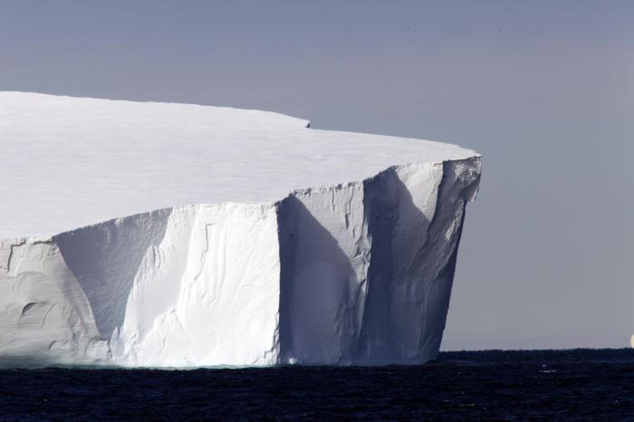
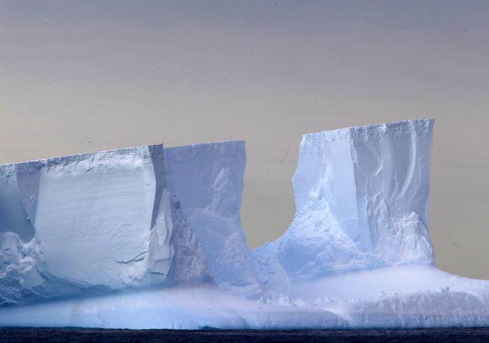
Many of the icebergs here off Wilkes Land came from the Ross Ice Shelf – the world’s largest ice shelf. It is over 1500 km away in the Ross Sea but icebergs travel great distances in the Southern Ocean. The water is cold and they drift with the ocean currents, for decades in some cases. As they drift, they melt a bit below the waterline and become rounded. Sometimes they flip over and this rounded part is then visible. Icebergs often collide and gouge away at each other or they list over at an angle and slowly fall apart. This means that icebergs come in all shapes, sizes, and textures.
The biggest iceberg we’ve seen was over 20 km long.
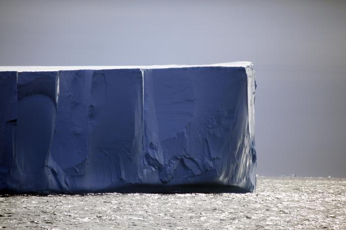
Icebergs come in all colors, from the pure white of fresh snow to the deepest blue of pure crystalline ice from far below the surface of the ice sheet.

Icebergs come in all shapes, sizes, and textures.
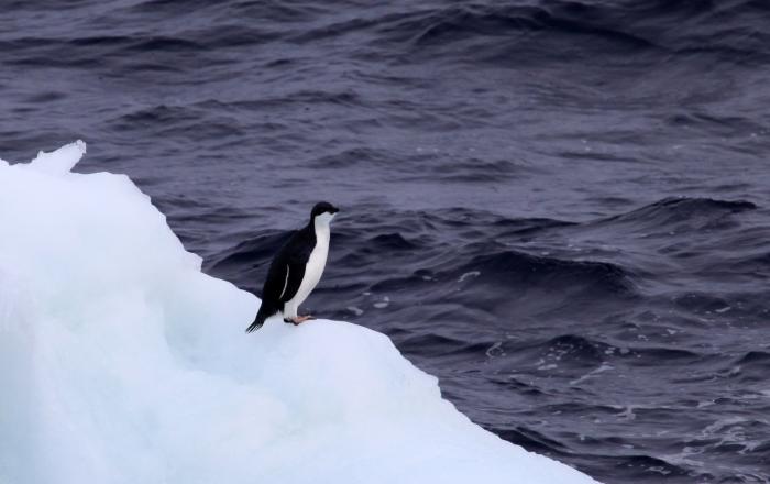
A penguin on a growler (a small iceberg).
The ice at the base of the ice sheet often carries sediments: boulders, gravels, cobbles, and sands. When these parts break off and begin to float they form “dirty” bergs with dark rocky layers intermixed with the clear blue ice. The debris that falls from these dirty bergs accumulates in sediments at the seabed. When we see gravels or sands in otherwise fine-grained sediments, we know this debris was transported out over the ocean by ice. In fact, the presence or absence of ice-rafted debris is something we keep close track of in the cores we are collecting on this trip – this tells us whether Antarctica was generating lots of icebergs and therefore had at least some kind of ice sheet in the past. Conversely, when we see sediments that do not contain this debris we know we are looking at a record from a time when Antarctica was much warmer.

In the foreground, a dirty iceberg.
We’ve seen over 400 icebergs in the past 2 days.
As I write, the storm has abated and we are transiting back to our drill site.
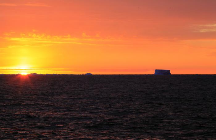
Dawn at 4:30.


Wow to have seen only 400 in the last few days is amazing.Loved the pictures and the one of the penuign too.I look forward to reading more.
Your photographs of the icebergs are breathtaking. Thank you 10,000 times!
Thank you so very much for this – I guess it is called a blog (as a senior citizen, I’m unfamiliary with the correct terminology). That aside, I lived in Alaska during the year it became a state and was extremely fortunate to see my first glacier, Portage Glacier – in fact, was able to actually walk on it. (I understand that today, Portage Glacier would not be as accessible to foot travel.) That experience of living in Alaska for just one year drove my interest in glaciers over the years. Now that I am (involuntarily) retired, I spend much time going on-line to locate sites like this one. Thank you again for contributing your expertise, not only in text, but in photographs, as well. I have, through trial and error, managed to place your site on my computer’s home page and have included McMurdo’s weather with my local weather on this home page, as well. It is too late in my life for a return trip to Alaska (with Alaska being my favorite location of all travel done as a military wife), so I shall just continue to soak up the words and visions of your site (in addition to all the books on the subject that I am able to retrieve from my community library). My sincere thanks to you for the effort you have put forth on your site which enables others to share your experience.