First Look
 No comments
 MCMURDO STATION, ANTARCTICA– We’ve completed our second successful science flight to Terra Nova Bay Friday night into Saturday morning. This was a 16.5 hour flight that covered a distance of a bit over 1300 km (800 miles).
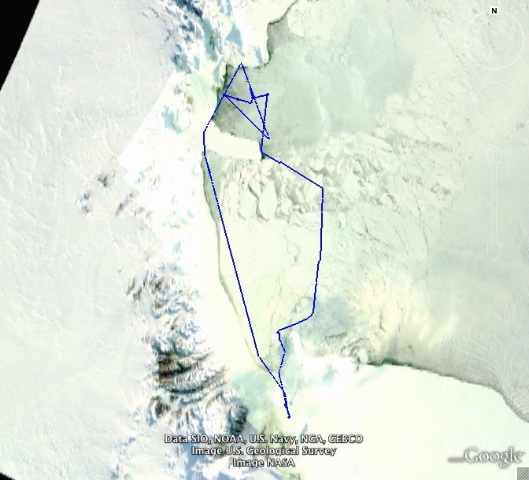
Flight path for our second science flight to Terra Nova Bay. The Pegasus ice runway, where the Aerosondes take-off and land, is at the bottom of the image. Terra Nova Bay is at the top of the image and is approximately 350 km north of Pegasus.
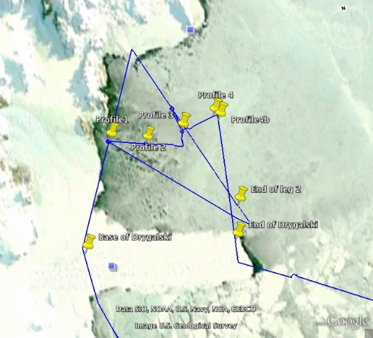
Close-up of the flight path over Terra Nova Bay. The yellow pushpin symbols mark locations where we had the Aerosonde spirals up and down between 150 and 1500 m altitude to measure the vertical structure of the atmosphere.
The purpose of this mission was to observe the low level winds and temperatures in the atmosphere, with the goal of relating these to the processes happening at the surface of the sea ice and ocean. To help us relate the atmospheric processes to the surface processes we took aerial photographs as we flew over Terra Nova Bay. Seeing the surface state will be very useful as we try to understand the meteorological data we’ve collected.
The flight arrived at Terra Nova Bay around sunset, so we didn’t have much time to take aerial photos before it became dark, but the photos we did get are stunning and raise some interesting questions that we’ll be trying to answer as we analyze the data we’ve collected. One of the big questions is how there was almost no open water despite winds blowing offshore at over 50 mph.
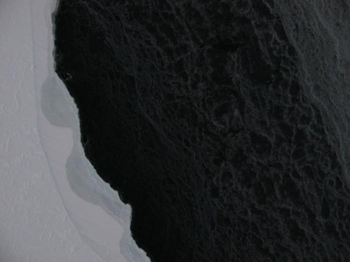
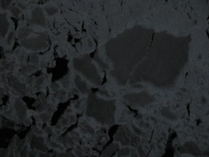
The edge of the continent – the Nansen Ice Shelf (left) and Terra Nova Bay with a thin coat of sea ice and maybe just a little bit of open water (right).
All of the aerial photographs shown here were taken from an altitude of 150 m and each image covers a horizontal distance of approximately 150 meters.
All of the photographs were taken on the first leg of the flight (the leftmost blue line) in the flight path shown above.
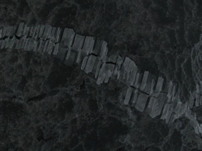
The violent mixing caused by the strong winds creates some stunning patterns in the sea ice. In this photo thin slivers of sea ice are rafted onto adjacent sea ice in a process known as “finger rafting”.
One of the common features we observed in the aerial photographs was bands of thicker ice (the brighter white ice in the image) oriented in the direction of the wind. In this photo the wind is coming from the top left corner of the image and is blowing at 50 mph. You can also see some areas of thin ice or open water (the darkest areas) where waves are present.

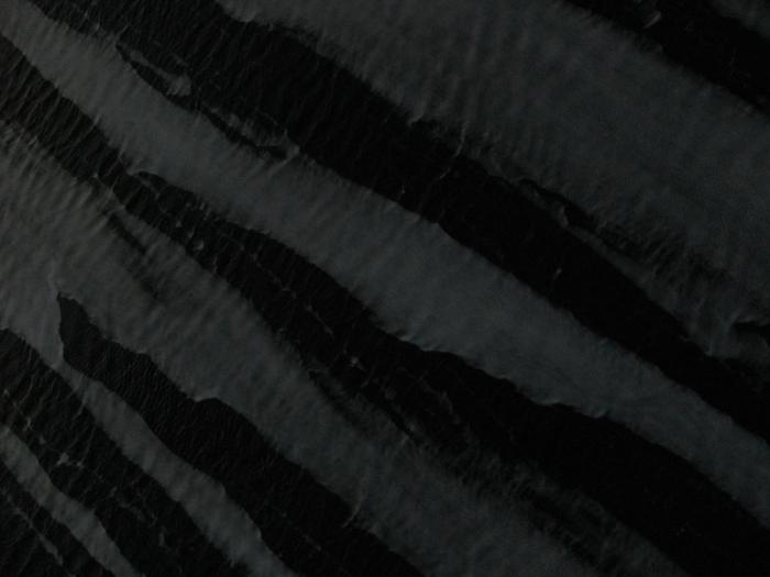
Another surprising feature seen in the photographs was the presence of ocean waves traveling under the sea ice surface as seen in this photograph. Given the very small amount of open water that we observed it is surprising that any waves were generated at all, since waves are created when winds blow across the surface of the water.
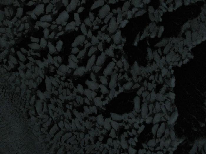
Patterns in the sea ice.
You can see areas of open water (or very thin ice) (darkest spots), areas of thin ice (dark grey) and areas of thicker ice (brightest areas) in this image.
We are planning to switch to daytime flights this week, since the days are getting long enough to allow us to launch at first light and fly until dusk and still have 14 or 15 hour missions. Of course the time between sunrise and sunset is just at 12 hours right now, as it is everywhere on Earth on 21 September. What will allow us to fly 14 or 15 hour flights and still take-off and land in daylight is the fact that the length of twilight before sunrise and after sunset is very long here. We’re hoping to get lots more images of the polynya during these daytime flights.