
First Flight
 2 comments
 MCMURDO STATION, ANTARCTICA– Our reason for being in Antarctica is to fly small unmanned aerial vehicles (UAVs), known as Aerosondes, to make measurements of the atmosphere and ocean over the Terra Nova Bay polynya (an area of open water surrounded by sea ice). Today we took a major step towards that goal when we completed our first Aerosonde flight of the trip. This flight was a short test flight, which lasted just over 1 hour while the aircraft circled close to the runway.
This flight was a record setting flight in a number of ways.
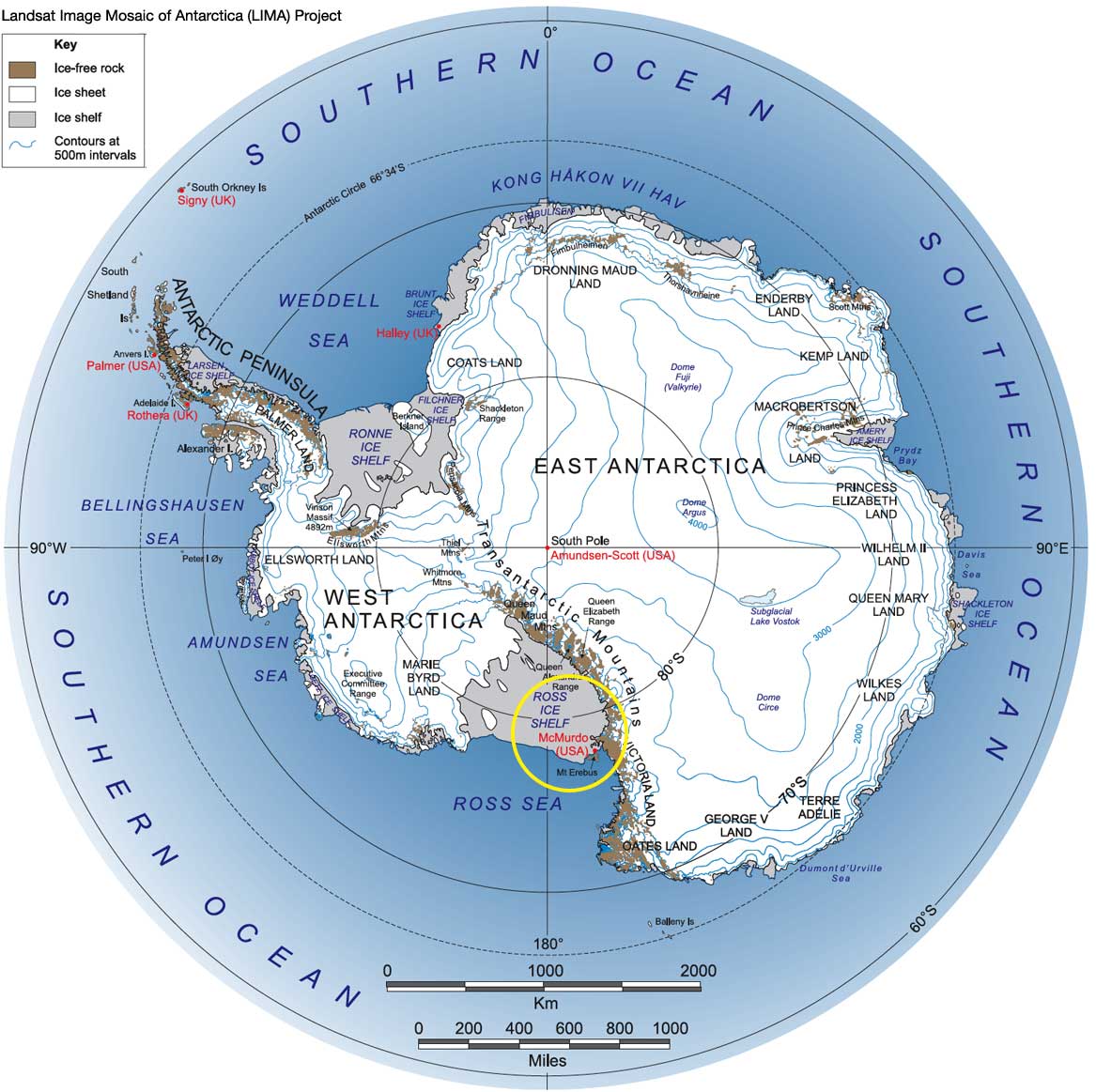
As far as we know this flight is the southernmost UAV flight ever. The British Antarctic Survey flew a small UAV, similar in size to our Aerosondes, from Halley Station (located at 75.58 degrees south latitude) in 2007. Our flight today was from the Pegasus white ice runway located at 77.96 degrees south latitude.
One of our team members, Jim Maslanik, a co-investigator on this project, recently returned from a research trip to Svalbard, Norway, where his team completed the northernmost UAV flights, which went as far north as 81 degrees north latitude. In the span of 2 months Jim has been involved in UAV flights that spanned 160 degrees of latitude, almost pole to pole.
Another first for our flight today was that it was the first Antarctic UAV flight made during the Antarctic winter (which ends on September 21st). The temperature at launch today was a very wintry -32 degrees C (-25 deg F).
Today’s flight was also the first UAV flight for the United States Antarctic Program (USAP).
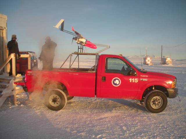
Aerosonde on launch vehicle at Pegasus runway (5 September 2009).
Check out these videos to see the Aerosonde in action.
This video below documents the first Aerosonde UAV flight in the Antarctic (7 September 2009). The Aerosonde is launched from the top of a pickup truck once the pickup has reached a speed of 60 mph.
Get the Flash Player to see this player.
And here, the Aerosonde UAV lands on its belly (it does not have landing gear) on the Pegasus white ice runway.
Get the Flash Player to see this player.


Hey John – cool stuff (no pun intended). Brings back fond memories. Good luck with the rest of the flights. Say “Hi” to Terry Deshler if he’s down there…
Teammates–
Excellent effort this last September. NASA’s Environmental Research Aircraft and Sensor Technology (ERAST) Program was started to gain information on the environmental changes taking place in Antartica in the 1990s. The ERAST focus, however, was on measuring and mapping the ozone hole in the atmosphere. Your efforts to measure and map the holes in the ice are very important as well. Good Luck and God Bless!
Richard Wagaman
Industry Representative, NASA ERAST Board