
And Miles to Go Before I Sleep

Journal Entry 6: Thursday, July 3rd, 2008, 1:30pm
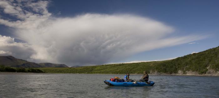
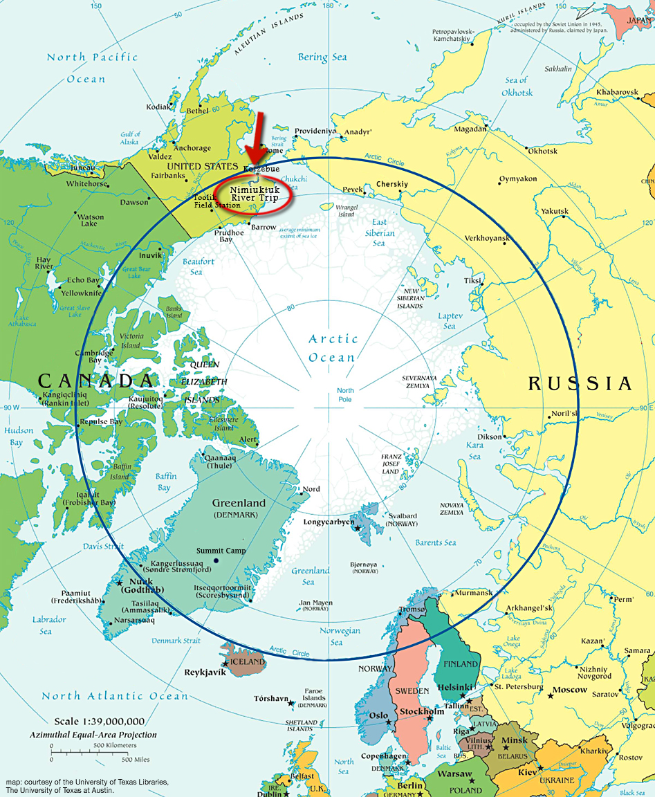
ON THE WATER, NOATAK RIVER, BROOKS RANGE, ALASKA– Long, hot days on the river. We finished the sampling a couple days ago, and yesterday boated the remainder of the Nimiuktuk River, eventually reaching the confluence with the Noatak River. With our precious science bounty aboard, you can be sure that we are boating conservatively, which proved challenging on the heavily braided and obstacle-strewn Seagull Creek and Nimiuktuk River.
Now on the Noatak River, there are fewer channel decisions and fewer obstacles to avoid, so we switched from two people canoeing each boat to one rowing and one resting in each boat (I am resting at the moment). This allows us to move downriver for about 10 hours a day, which is critical to stay on schedule and still leave time for repeat photography downstream.
Looking back at the hail storm that hammered us for 5 minutes.
Explorer Philip Smith descended the Noatak River in 1911, leading a United States Geological Survey (USGS) party mapping the terrain and geology of the region. At the time, the USGS party would’ve been one of the first white man parties in the area, preceded only by miners, and of course, Native Alaskans. Armed with prints from Smith’s expedition, we are seeking to relocate and “repeat” a number of his photos.


hey man, looks beautiful! i’ll be up there on monday, paddling from pingo to noatak. can’t wait. hope you have a safe and relatively warm/dry trip. cheers, stefan (from carleton)